| Activity | |||||||||
|---|---|---|---|---|---|---|---|---|---|
| Type | Name | Description | Service Provider | Cost | Kms | To Date | Total | Notes | Actions |
| Cycle | Schillingsfurst to Nordlingen | Today: 71km; Total: 466km | $0.00 | 71.00 | 71.00 | ||||
| Sight See | Dinkelsbühl | $0.00 | |||||||
| Accommodation | |||||||
|---|---|---|---|---|---|---|---|
| Type | Name | Service Provider | Confirmation | Location | Cost | Notes | Actions |
| Pension | Hotel Garni Kirchenwirt am Daniel | $90.00 | |||||
Trip Log
| Notes | Actions |
|---|---|
|
We had sort of chosen Dinkelsbuhl as our destination for tonight. It was only 40km down the road, but also the only place before Donauworth with a Campingplatz. Thanks to Brent and the Bikeline book, though, we were able to shave off more than 10km by taking a shortcut route. When we pulled into Feuchtwangen for “first coffee”, we noticed two signs for Dinkelsbuhl – one was 26km and one was 14km. Laura and I looked at the Kompass map and decided that the shorter route was on a highway, which we weren’t interested in doing, even though the official route took us WAY out of our way for no points of interest. Thankfully Brent looked at the Bikeline book and found the actual shortcut which was NOT on the highway at all – it was on pathways and side roads. We followed the shortcut and made it to Dinkelsbuhl in only about 30km.
After Dinkelsbuhl, we dreaded a section outside of Ruhlingstetten, which the authors of “The Romantic Road” said they “found it to be the roughest bit of track on the whole Romantic Road route”. Rather than ride that bit, Laura sketched us out a detour taking us through Unterbronnen. In Unterbronnen we stopped to re-consult our maps and had a wonderful chat with four young local ladies eager to try out their English on the “Canadians”. They were very helpful and pointed us in the direction we wanted to go. The remainder of the detour took us up a steep steep hill, at the top of which we made another friend who stopped to give us directions and then introduce us to her dad and nephew at the farm on the hill. Our next thought for where we might stop for the night was Wallerstein. It was just shy of Nordlingen and had a Penzion listed in Brent’s reference brochure. That didn’t pan out, so we started calling Penzions in Nordlingen. On the first call, Brent got a person who spoke English, but the Penzion was booked up for the night. On the second call, we got a person who didn’t speak English, so since apparently I have the most German of the three of us, I took over the call and managed to procure us a couple of rooms at Hotel Garni Kirchenwirt am Daniel in Nordlingen, which is right on the main Platz (across from the enormous church). It was quite the lucky find. After we settled in to our Penzion, we went in search of dinner and randomly chose a German restaurant… with Croatian items on the menu. The proprietor is a transplant from the former Yugoslavia, so Laura and I enjoyed some Croatian food (Brent stuck with schnitzel)… and I mean we ENJOYED some Croatian food. It was amazing AND enormous. |
|
|
While we were riding the Main, I didn’t miss the Bikeline guide at all. I’d given it away before we’d even left the airport and we made out just fine with only the Kompass Map.
On the Romantische Str, we have the Kompass Map, the Bikeline Map/Book, AND “The Romantic Road from Wurzburg to Fussen” guide. We are finding all three to be absolutely essential reference materials, and we’ve also added the “Places to Stay” brochure that Brent picked up as an essential material. We also have my projected route/schedule, which we’ve been referring to constantly, and the info about the towns of interest along the way. The Kompass Map is great for a contiguous view of the route and for the cumulative kilometer markers. The Bikeline map is better for the elevation profile, alternate routes (i.e., shortcuts) and hill indicators. The “Romantic Road from Wurzburg to Fussen” is excellent for commentary and detailed instructions. The Bikeline book probably has that as well, but it’s all in German. It’s nice to have it in English. |
Photos
-

Riding in the fog
-
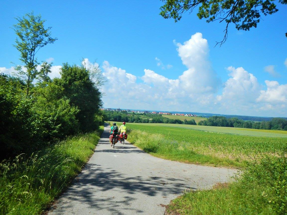
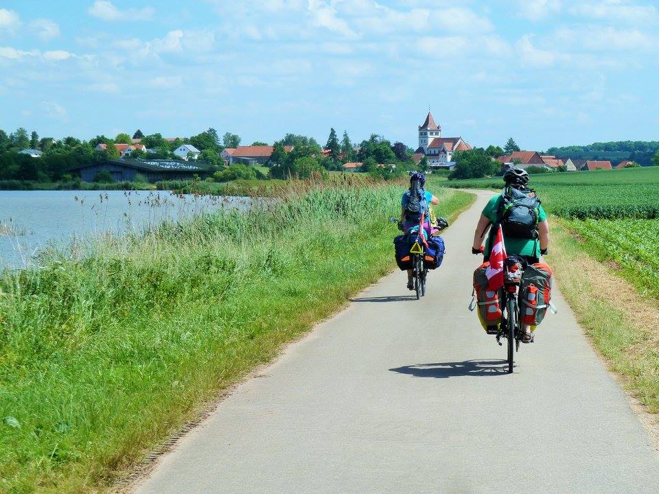
Pretty countryside
-
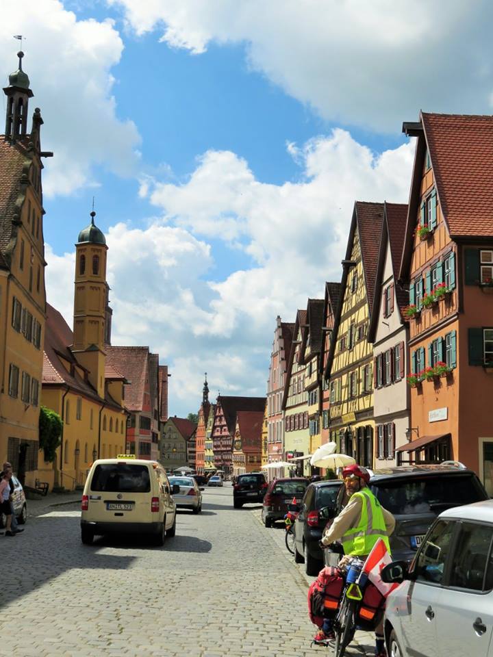
Dinkelsbuhl
-
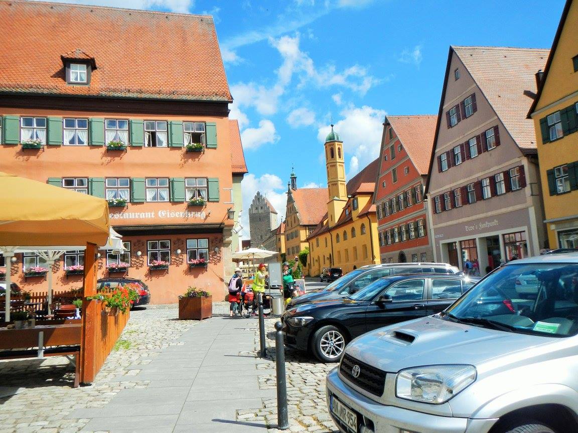
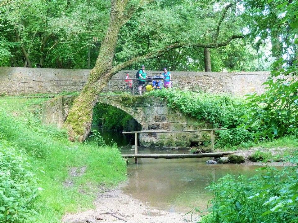
Map Nerds
Brent and Laura check out the Stadtplan for Dinkelsbuhl -
Climbing a hill
-
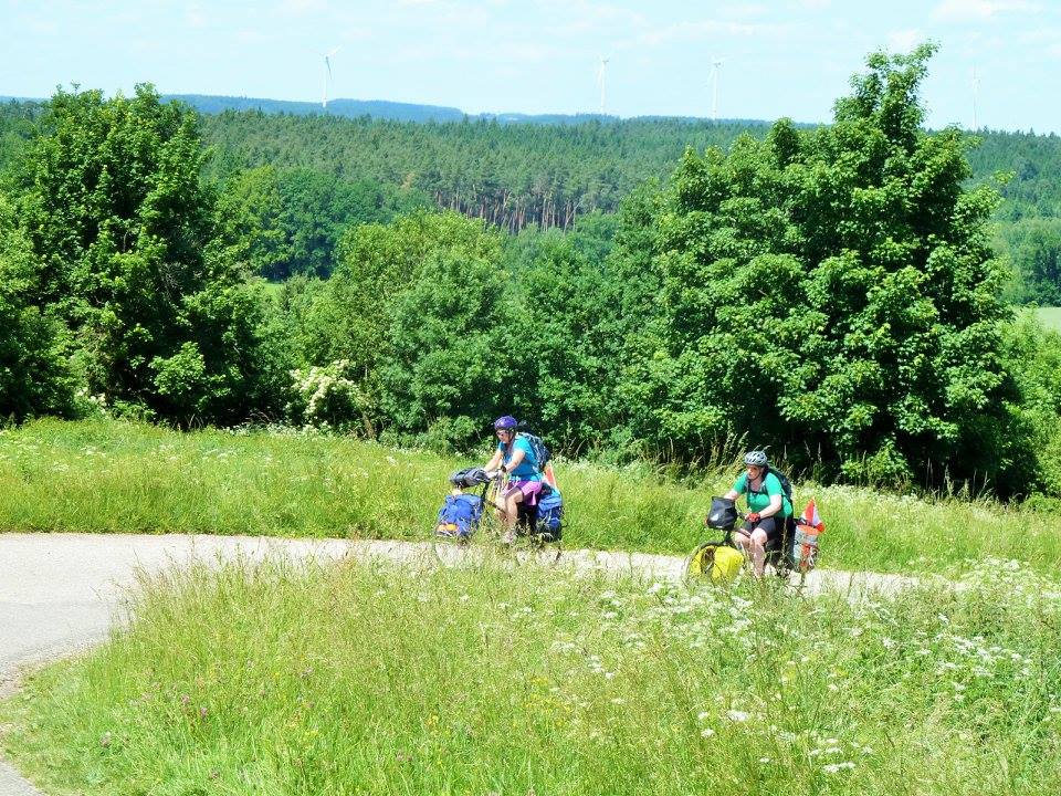
Pretty countryside
-
Pretty countryside
-
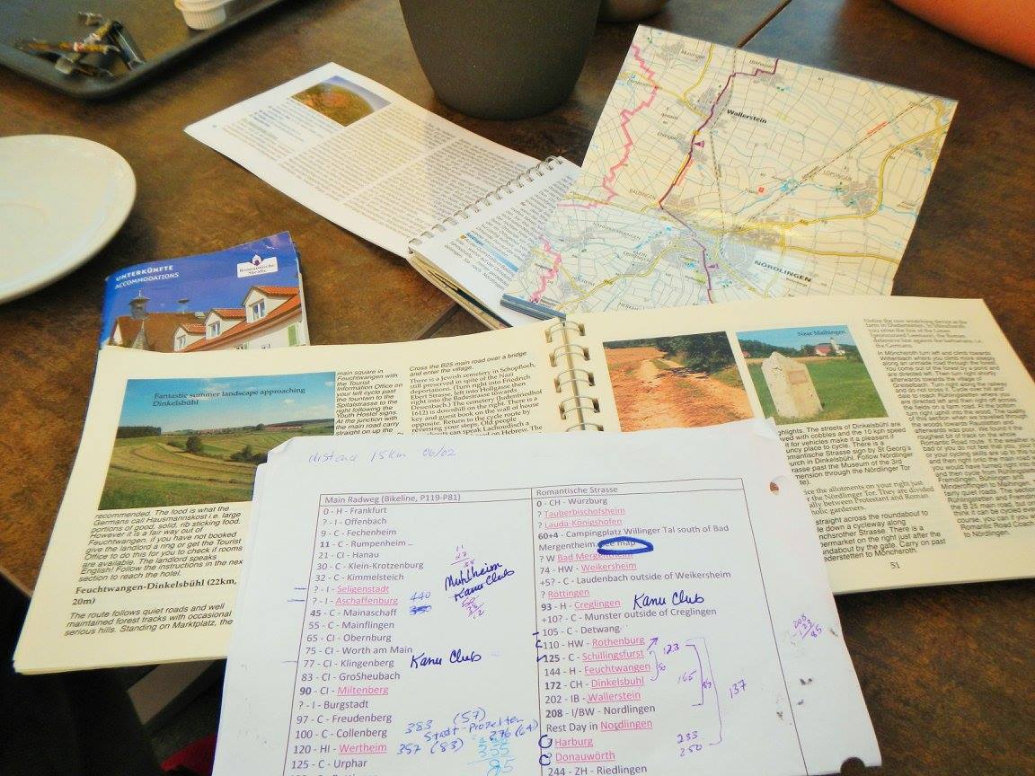
Multitudinous reference material